Adventure / touring / gravel bikes are great, aren’t they? They allow you to get out on the road and almost hang with the best road bikes out there. They also let you depart from …
I recently modified a mountain bike that came with a 2×11 drivetrain. It was nice, but I wanted a wider gear range. The result was a 10/42T 11 speed cassette paired with a 40/24T 2x …
It is time for another not-very-pretty blog about bike equipment. I made a tank that I think can seat just about any bead lock bike tire. This is an over-the-top tool but I had to …
On Day 3 I awoke to an empty campsite, though there had been another cyclist there the night before: Reuben. But I knew that Bigfoot had not scared him away during the night. Reuben had …
Shoe stretchers are hardly anything new. But I have never heard of anyone using them on bike shoes. I thought it might help the fit of some of my shoes. I tried it and I had …
I want to begin by pointing out that I am not a doctor of any kind. However, I ran a bike shop for years and helped people get comfortable on their bikes. See a doctor and/or get a proper bike fitting if you have serious riding pain or similar issues. This is another in a series of beginner riding tips.
You would think the simple answer would be to stop riding with locked joints and that would be the end of the lesson. It’s not.
When riding, you have a lot of joints that are static, i.e. they not moving. For example, think about what your shoulders and elbows are doing when you ride. They are working, but not bending or flexing through much of their possible range of motion. The overarching rule for joints like these is that you want to keep these joints partially bent and able to move in two directions. Imagine trying to keep your entire body like a partially compressed spring, able to absorb compression or extend when needed. Specifically:
Position your wrists so your palms are angled just a little above your forearm, not locked upward.
Bend your elbows out a little, just enough to unlock them. Don’t lock them inward.
Keep your shoulders down and relaxed, not shrugged.
Don’t lock your back and neck or “arch” or “hunch” them to the limit of their movement. The back and neck are a bigger topic that I will cover in more detail in another article.
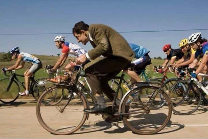
Do NOT use Mr. Bean as an example of good riding posture.
Get it? Its okay if you don’t.
The reason we lock these joints is that it allows the bones and ligaments to support our body weight, not our muscles, so we don’t get as tired. But if locked joints sound bad, that’s because they are. Really bad. If your joint is flexed to one end of its range and you hit a bump or something causes unexpected movement, it can force the joint to be flexed beyond its limit. Locked joints can pinch nerves, inflame joints, cause numbness, and irritate arthritis. But these symptoms don’t surface until the long run, so they are not always associated with riding posture. People will ride with their wrists and elbows locked and ask why they have numbness in their hands sometimes. It is not always natural to link the two together. On the other hand, riders feel immediate muscle relief when they lock their joints, so there is a clear relationship between the two.
So you would think the simple answer would be to stop riding with locked joints and that would be the end of the lesson. Unfortunately, riders often experience pain when they start riding with properly flexed joints. This is because they are using muscles for support instead of locked joints. Supporting your weight using these joints in this way is pretty specific to cycling. You don’t do it when you walk, sit, run, swim, etc. So those muscles may not be in very good shape for this kind of activity, and the pain riders experience is most often due to sore muscles, not nerve issues as riders often think.
Sorry, that won’t help.
You may need professional help.
Further complicating matters is the fact that cycling does not exercise those muscles very well because they don’t move much while riding. This kind of muscle activity is called isometric. Isometrics are very good, but usually in combination with other exercises that move the muscles too. Imagine trying to get strong biceps without actually moving your arms. So simply riding more is not always the answer.
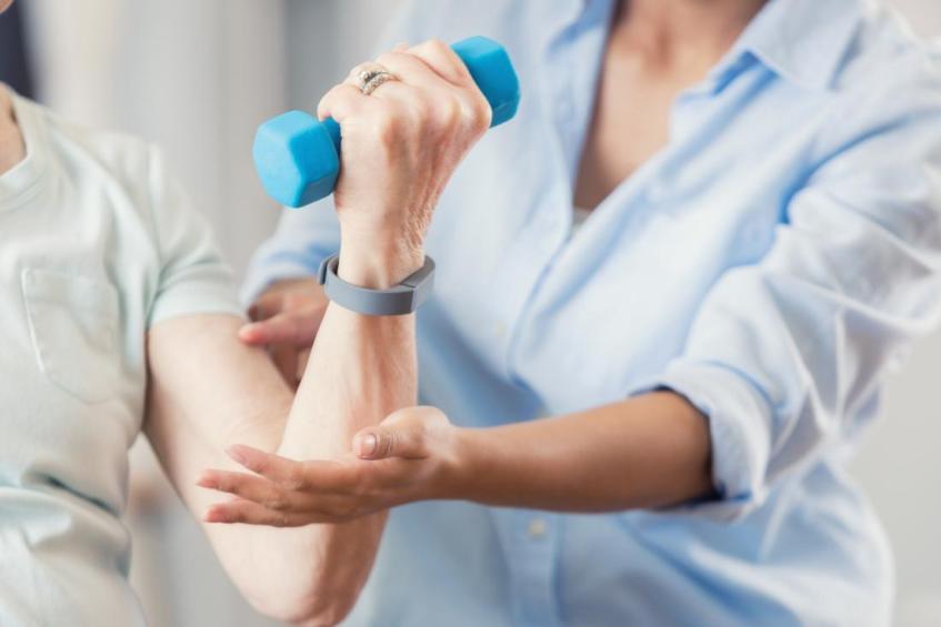
It is a good idea to do some kind of exercise for these joints in ways that involve a range of motion. Such exercises are called cross-training since the goal is primarily to support another activity. And don’t confuse it with CrossFit, which is a bunch of crazed gym rats turning exercise into a competition. Core exercises are commonly mentioned as good cross-training for cyclists, and they are. But so are exercises specific to your neck, shoulders, etc. The details of those exercises are beyond the scope of this article, so going to the web, your doctor, the gym, or a bike shop may be necessary. Don’t wait until you are in pain before you do some cross-training. Get in front of the issue and make it part of your regular routine as you ride more.
eBiking has brought many new riders into the two-wheeled world. Some are young people who are riding on the street for the first time. Some are older people who are enabled by their electric steed. In many cases, the eBike has enabled them to propel their bikes forward without all the skills needed to do it safely and in consideration of others, i.e. they never learned some of the basics of riding. This is one in a series of articles about the basics of cycling at a time when, at least where I live, many riders are in need of learning the basics.
Ahhh, the carefree experience of coasting. But is it really?
Where you place your feet when coasting is important. Done wrong, it can lead to accidents and injuries
Coasting along without pedaling is one of the greatest sensations you can have when riding. Coasting down a hill, with the wind at your back, as you coast down to take a break, and even after a kick from your electric motor, is a true sensation of simplicity and freedom. But it may not be as free as it seems. There is a right way and a wrong way to do it. And when done wrong it can lead to accidents and injury.
Where you place your feet/pedals when coasting is important. And pedal placement is different for different situations. When coasting through a curve, rotate the cranks so the outside (of the curve) pedal is down and the inside pedal is up. This lets you transfer your weight properly for cornering and gives you better clearance.
You may not ride a race bike, but your pedal position should be the same.
When coasting in a straight line, keep the pedals level, i.e. at 3 and 9 o’clock. This allows you to use your legs as a suspension so you can absorb bumps without being bounced around and move quickly to the right cornering position. In other words: when your pedals are at 6 and 12 they are mostly extended or bent, so you can’t absorb bumps nearly as much and you may have them the opposite way you need them for an unexpected curve or swerve.
When you coast to a stop, rotate one pedal down at the last second to allow you to get a foot to the ground and stop.
If you watch any pro bike video, you will see that this is how they all coast (there are a few other advanced techniques though), it is second nature to experienced cyclists. But beginners may have to consciously think it through for a while before it becomes a habit and just “feels right”.
If respect for human life is not a good reason to respect cyclists, maybe caring for the planet is.
I live in southern California, where a large percentage of the population consider themselves “green” or “environmentalists” or “tree-huggers.” The streets here are brimming with Teslas and Priuses, and buildings are festooned with solar panels. We vote in favor of gas tax increases and encourage people to “get out of their cars” and use alternative transportation like carpools or the minimalist mass transit system.
The irony of this occurred to me recently when yet another Prius tried to bully me off the road
I, too, consider myself active in fighting climate change. Among other things, I ride a bike and eBike for transportation rather than driving my car when possible. I have bags and a trailer for my bike and I use them to commute and run errands. I put thousands of miles a year on my bikes that would have otherwise been put on my car. Bikes and eBikes are far more green than hybrid or even fully electric cars. And the reality is that electric cars are still priced beyond the reach of most people.
With the sudden popularity of eBikes I expected to see more people using bikes as transportation. Yet I rarely see anyone else using bikes this way. Whenever I go to the grocery store, I stop and answer questions from people about what I am doing, implying that they have never seen anyone run errands on a bike. My conclusion is that people ride bikes for recreation almost exclusively.
It should not be this way. Where I live, most roads have dedicated bike lanes with clear lane markers and labels. But most eBike riders ride on sidewalks, which is usually not legal and creates problems with pedestrians. Or they ride only on dedicated bike trails. Those are nice, but they rarely give access to the places needed for commuting or errands. I talk to people online and in-person, and the reason for all of this is clear: they are afraid of riding on the street with cars.
I ride on the street anyway, so this fear I see in others is not surprising. There are a lot of street-specific skills and techniques that I have gotten comfortable with during my 35 years of bike commuting that keep me safe. But the reality is that even on very short rides, I encounter drivers who intentionally try to run me off the road. They pass as close as possible to me on the right (California has 3-foot passing law), often driving in the bike lane after passing me. They cut me off to take a right turn in front of me so close to me that I have to hit the brakes very hard to avoid hitting them. They pull out in front of me, honk at me, yell at me, throw things at me, swerve at me, and tell me to “get off the road” even though I am riding legally in a marked bike lane. These have been constants during all of my years as a cyclist. Learning to deal with them emotionally is an important skill.
The irony of this occurred to me recently when yet another Prius tried to bully me off the road. We have miles of bike lanes that could be used to reduce our carbon footprint, but they are not, and for one simple reason: “green” drivers go out of their way to scare cyclists off the road. They do it a lot, and it works
My message to the self-proclaimed green people of California is this: support cyclists you see on the road who are working just as hard as you are to save the planet. Give them more than the 3 feet required by law. Make eye contact. Smile. Wave. See them. Accommodate them. Protect them. Care about them.
As a footnote, I have a suggestion for law enforcement as well. Many motorists use their vehicles in such a way that it qualifies as brandishing a deadly weapon. By coordinating an officer on a bike with another officer in a vehicle, these motorists could be cited. It would not take a lot of this before the word got out that random cyclists were police officers, which would be an effective deterrent. I have read that this is being done in some places and I think we need more of it.
eBikes are getting more popular all the time, so it is easy to buy a complete ready to ride eBike. But it wasn’t always so. For years I have been making eBikes by converting regular bikes with a kit consisting of a motor, battery, controls and electronics. Ready made eBikes often have specific mounts for the battery, but for conversions you need to get creative. The most popular ways to mount a battery are on a rear rack, on the down tube using the water bottle “braze ons”, or strapped to the frame.
For my latest eBike conversion project I made a different kind of mount. I mounted a “triangle” battery in the front triangle of the bike frame with two custom “cradles”. This allows for a very large battery. The cradles are riveted together “L” section aluminum stock that support the battery on the bottom and sides. The cradles serve as both a mount and a partial case/protector. They are more compact than a bag or case and have proven to be durable. By using both water bottle mounts the system is stronger overall than a down tube only battery mount, and in particular it gives the battery much more side to side stability. This mount allows for a low center of gravity, near to the center of the bike lengthwise, and is supported by the biggest and strongest tubing on the bike.
These are the cradles, installed and field tested. I can’t get any paint to to stay on and look good. But the rough look distracts from some of the imperfections anyway.
This is not a full how-to plan with lists of parts, dimensions, etc. If you make one yourself it will be custom, so what matters is the overall design. Think of this as a baseline design with modifications as needed. I will share the modifications I had to make as examples. You may not need them all, and you may need to come up with some of your own.
In more detail: The cradles are made with two pieces of L section aluminum stock like you can get at most hardware stores. I used a medium thickness aluminum. The L stock pieces are connected with 2-4 cross strips of aluminum flat stock. Two of the cross strips need to line up with the water bottle braze ons and are drilled for the mount bolts, others can be at the ends of the L sections. The inside of the tray should be lined with padding everywhere the battery touches. The battery needs a strap routed outside of the cradles over the top of the battery since there is no top cover. Locating the strap is between the braze ons will prevent it from sliding past them. I used aluminum pop rivets to connect the various pieces of aluminum stock. Done right, pop rivets are light, low profile fasteners, plenty strong enough for this application.
I was hoping my choice of materials and construction would be durable, and based on a year of testing, it has been. I chose aluminum stock and rivets makes to it light and easier to work than steel hardware.
Note: these pictures may make the cradles more complicated than they really are. They are a simple design with a couple of twists thrown in, and a few mistakes visible in the pictures. If I could make them over again I could fix some of those mistakes, but they don’t affect the function of the cradles so I am leaving them as is.
The cradles have passed the test of a year of steady use.
You can see how the strap is routed, where the cross members are located, and the rubber liner.
Note the pop rivet locations. I used rubber on the bottom of the end cross pieces to protect the frame. One side is attached by bolts instead, for battery access. Only 3 of the bolts were used, though a 4 was prepped for.
This is the down tube cradle with the battery removed, and removed from the bike.
The seat tube cradle installed, battery removed.
The frame bolts need to be reached through the inner cradle.
This shows the cradle in cradle design. The outer cradle aligns with the bike frame, the inner one supports the battery.
This is the seat tube cradle with the battery removed, and removed from the bike.
As for tools, a pop rivet tool is required. I had a little learning curve figuring out how to install a secure pop rivet so you might want to practice and find a how to video about that. I used a Dremel for cutting smaller pieces of aluminum stock and for trimming, buffing and rounding sharp corners. A compact circular saw is good to have for the bigger cuts. You could do big cuts with a Dremel, but it is slow and eats up a lot of cutting wheels. You will need a drill for the pop rivet pilot holes and frame mount bolt holes.
Here are the modifications to the baseline design I needed to make, your mileage may vary:
Removable L section on one cradle for battery installation/removal. The basic design is simple but you will probably need to address the issue of allowing the battery to installed and removed. If you have enough clearance between your battery and frame, you may be able to angle the battery and drop it into the cradle. But my battery fills up too much of the frame to allow for that. I made one L section of the down tube cradle removable. Instead of rivets, it is held in using short bolts, flat nuts, and slots that allow it to slide in and out.
This is the bolt and slot for the removable L section. The bolt is loosened, not removed, allowing the section to slide out and the battery can be removed.
The flat nut has a low profile and is close enough to the side that it never spins out.
Down tube cradle with the removable side removed. The 4th slot is not used. It is best to have the slots oriented this way.
Details of the removable L section for the down tube allowing the battery to be removed.
Compensating for battery shape mismatch with the frame. The shape of the battery and your bike frame triangle will probably not be an exact match. To get the best support, the battery should rest squarely at the bottom of the both cradles for the entire length of the cradle. I made the seat tube cradle a “cradle within a cradle” design. The outer cradle aligns with the bike frame and the inner cradle aligns with the battery, and the two cradles are pop riveted together. This double cradle design solved another problem for me: my battery cables exit out the back of the battery in the center (side to side). That is where the seat tube is, and my battery cannot rest against that or it will eventually bend and break those cables. The double cradle also holds the battery away from the frame and gives the wires room to exit without a sharp bend.
Allow room for a front derailleur. My bike has a rear hub motor which allows for the use of a front derailleur and a wide range of gearing. I had to cut away part of the seat tube cradle to make room for my derailleur. There are many kinds of front derailleurs and mounting options, and many people don’t bother with them at all, so this is definitely a custom issue. I used a bit of trial and error to get mine to fit, marking it and trimming away bits of he mount until it worked.
It took several passes removing material to make room for a front derailleur.
The lower cross piece has held up well , even with the single rivet and small contact with the L section on the right side. The double cradle adds strength as well as making a good battery contact surface.
Seat tube cradle, modified to allow for a front derailleur.
The things I did to monitor the battery for the first year are good ideas to continue as regular maintenance. I periodically remove the battery to clean and inspect it and the mount. I have had to redo some of my rivets that were becoming a little loose. One of my frame braze ons fell off and into the frame. That was an issue with the quality of my bike frame, not the battery mount. I replaced it using a standard bike rivnut tool. The new rivnut is stronger than the original one and was pretty easy to install.
This mount allows me to install a big 1.6kWh battery pack, good for over 100 miles easily, maybe up to 150 miles under ideal conditions with minimal (but still useful) levels of assist. The end result is what I call an “adventure” eBike. Due to the size of the battery, I can use this for doing big all day rides like centuries, exploration, hauling loads, doing errands, touring, etc. without range anxiety. I am happy enough with the results to recommend it and share it with other eBike DIY builders.
I awoke on the morning of day 4 in Westpoint Union State Park greeted by a classic California coastal scene visible outside of my tent. From the seaside bluff where my campsite was set up, light fog drifted lazily up from the beach below, cresting in slow motion wave over my campsite. The warmth of the morning sun poked through the fog here and there, but it was still a little cold and damp at ground level, so I stayed under my vestibule as the morning grew warmer and my tent dried off.
Mendocino is an absolute gem of a town. Like Fort Bragg, the bike paths between the town and the ocean are not to be missed
I was pretty excited about the route that day. This was another relatively short day and I planned to take my time riding bike only coastal trails and spending time in the scenic towns of Fort Bragg and Mendocino, among others. I got packed and I was riding early as usual.
The partially collapsed road that runs through Westpoint Union State Park used to be either the main road through the state park or Shoreline Highway itself, I was not sure. But the California coast was having its way with the road. The steep cliff down to the ocean was advancing inland over time, causing the road to either break apart as the land underneath it shifted, or completely fall into the ocean dozens of feet below. Where the road was completely gone there were hiking/biking trails to skirt around the missing sections.
Elapsed Time
Moving Time
Distance
Average Speed
Max Speed
Elevation Gain
Calories Burned
06:54:34
hours
04:37:39
hours
41.91
mi.
9.06
mph
38.47
mph
2,312.99
ft.
1,736
kcal
As I continued down the road I discovered the park had another section of campsites. The camp host had instructed me to stay in the section where I had stayed. But maybe some of the other riders that I had hoped to meet had stayed in this last section. The park did not have any specific hike or bike spots as far as I could tell. This other section was bigger and had more people camping there, but it was still primitive, pit toilet only camping.
I eventually had to get back on the main road, which meant the occasional fast vehicle that did not move over for me at all, but they were few and far between.
Shoreline Highway had many signs warning drivers to watch for bicycles
The little village of Westport was the first bit of town of any kind that I had encountered since early the day before. The quaint little hotels were abuzz with activity and people coming and going. I stopped at the market in town and ate a hobbitesque second breakfast since my supplies from the day before didn’t go far enough. The market was a meeting place for people in town and local gossip was flying fast and thick while I was there. They were very familiar with seeing people riding the coast on bikes and were ready with sandwiches, water, candy and other goodies.
Back on the road, the rolling terrain to south clung to the ocean cliffs at times, then it wandered inland to ranches, hilly estates and groves of eucalyptus and birch trees. In a few places the trees covered the road in a full canopy, windswept and leaning inland, looking like they were planted that way intentionally to serve as a windbreak.
I was enjoying the scenery so much that I missed my “exit” in the little hamlet of Cleone that lead me down to a beach trail identified on the map as “Mackerricher State Park Road”. But it was a paved bike trail. I doubled back on the trail and rode the section I had missed so as not to miss any of it.
The morning fog took its time lifting. It added an almost artistic touch to the vistas as it faded away.
I backtracked to be able to ride all of the coastal trail that begins in Cleone
It was great to be down at the ocean level for the scenery as I rode, but it came at the price of a steady headwind. The trail that began in Cleone continued into Fort Bragg. It actually did too good of a job of keeping riders away from traffic because I missed the city of Fort Bragg completely. So I detoured back into town to make a few planned stops, including a sporting goods store, a bike shop and the Skunk Train. I wanted to stop at a deli for lunch, but the directions and recommendations I got in town were confusing, at least to my hungry brain, and there was a big construction project on the main street through down. I decided there would be plenty of other opportunities to grab a sandwich farther down the road, so I continued south out of Fort Bragg.
Downtown Fort Bragg was bustling.
The Skunk Train may have an unappealing name, but don’t let that put you off. It doesn’t stink (anymore) and it is a great place to visit for culture and history.
The little town of Caspar turned out to be a cute little village worth a visit. A little market nestled in the Caspar Headlands State Park was where I stopped and ate. As usually happened, getting some calories in me revived me and I was ready to push on. I kept off the main route and headed to the Cabrillo Lighthouse, which still has a spinning lamp atop it, a shop in the bottom, and homes that were once residences for lighthouse operators that are maintained and can be rented out for a stay.
My stop in Caspar for a lunch that I delayed for too long, but the side trip to their beach area made it work out OK.
These lovely authentic homes, formerly for lighthouse personnel, are part of Point Cabrillo State Park and can be rented out.
Mendocino was the next and final town of the day. This was my night to stay in a hotel. I plan my trips with one night per week in the luxury of a hotel, it is a good chance to get me and my gear really clean and dry. Mendocino is an absolute gem of a town. Like Fort Bragg, the bike paths between the town and the ocean are not to be missed, even if they are not the most efficient way to travel through the area. The coast there was rugged and windswept with few, if any, sandy beaches.
The coastal views along the Mendocino were almost too perfect.
With the fog rolling around, the artist capturing the moment and the perfect blue green water, it was one those surreal scenes that make you think you are in a living postcard or drifting through a dream.
Riding into the village itself, I rode up and down the streets of the downtown area, not wanting to miss any of the quaint shops, museums and restaurants. I eventually wound my way up the hill to my hotel for the night, and it was a welcome sight indeed. It had no on site restaurant or laundry. So I rolled back downhill to the local market for what I needed. The locals all knew each other and used the market as much as a meeting place as a place to buy food. No one seemed to be in a big rush. Back in the room I used the bathtub as a wash basin and hung everything out to dry around the room. I even had internet quality cell service, something I did not take for granted anywhere during the trip. I did my daily check in with my family, enjoyed the food from the market, and even did a little video streaming, but I did not last long. Sleep came fast and easily as it always does while bike touring.
The Ford House is one of several museums to see in Mendocino. The ocean makes a delightful backdrop for its picturesque streets.
The market where I stocked up was bustling with locals all taking time to say hello and visit with each other.
A civilized hotel room was a welcome place to stay for the night.
It has been a while since I have blogged on a ride, but certainly not since I have ridden. I busted out the camera for a blog and it’s time to share a few local secrets from this gravel ride.
My current gravel steed is a Diamondback Haanjo Carbon 7c. It is not included on most lists of gravel bikes to consider and that is a shame, but it is OK by me. I have updated most everything on my ‘jo, giving it a Di2 drivetrain and a second wheelset: a 27.5s with NoTubes Crest Mk2 rims and Project321 hubs with magnetic pawls. The frame is worthy of the good stuff, and the bike surprises me with how light it is every time I portage it over a stream. The hubs have so little spinning resistance they feel like they actually accelerate for a moment when I start to coast. The Schwalbe Thunder Burt 2.1 tires are the absolute biggest you can cram into the frame and fork, and I don’t recommend them for when it is mucky out: there is so little tire clearance that the abrasion of normal amounts of mud against the frame/forks would be worrisome. But for a dry dusty ride like this one they were no problem, as long as your wheel dish/truing is spot on. And since I build my own wheels I make double sure it always is.
An army of bulldozers attempted to tame Trabuco creek and put the gravel road back in place. It worked for a while. But the little creek had other plans and it shifted again, taking out the new road.
I once again plotted out my ride using RideWithGPS. I had a few goals: a lot of dirt, climb on pavement and descent on gravel, and stop at Docent Brewing in San Juan Capistrano, adjacent to a groomed dirt trail near the end. Consider it crushed.
An initial climb is rewarded with a sweeping coastal view.
Elapsed Time
Moving Time
Distance
Average Speed
Max Speed
Elevation Gain
Calories Burned
05:21:31
hours
03:22:42
hours
33.57
mi.
9.94
mph
25.95
mph
1,578.08
ft.
2,175
kcal
The early part of the ride was mostly on pavement, though some of it was dedicated bike trails like this relatively new one in San Juan Capistrano.A nice groomed trail in the Sendero Ranch area goes under San Antonio Parkway then connects with it via a shopping plaza there.
My climbing took me through Rancho Mission Viejo and on to Rancho Santa Margarita including the Patronnes Parkway bike lane. The lane is a mixed bag: it is a bike only route, but it is adjacent to a road that is for all practical purposes a freeway and separated by only a low cable fence. I had no problem with it, but it may not be for everyone, I get that. The main climbing was complete somewhere along Meandering Trail where I “summited” and descended quickly to Arroyo Trabuco.
This arch marks the transition from low traffic pavement to gravelly goodness.
During the drop into the arroyo a mechanical issue reared its ugly head. Under hard braking the fork got into resonance where it shook violently. It was easily remedied by lifting off the front brake momentarily and getting back on it a little lighter. It was manageable but far from optimal. I checked the adjustment of the thru axle and headset. It did not feel like those issues, which I am familiar with, and those adjustments were just fine. I was pretty sure it was a brake caliper/pad/rotor issue. The fork has been fine and the front brakes squeak for a moment when first applied, and that indicates vibration and less than optimal braking. I could have stopped and adjusted the caliper position but it was not worth interrupting the ride: I was in a good place and riding a wave of positive energy. I was not going to let an edge case brake issue get in the way. [Note: I discovered that this was front brake pads when I got home and swapped in a new set.]
The Arroyo Trabuco is some of the best classic gravel riding in the area.
There are several ways down the Arroyo. I chose the less technical route which allowed me to make a relatively easy stop at Starbucks. I am stuck on Nitro cold brews right now. I had a different brew planned for later.
The Nitro is my current favorite.
After ‘bucks I crossed the arroyo and dropped back in at my now-not-so-secret entrance, which gives access to more nice gravel riding. It used to be more straight up gravel riding. Then a season of rains caused the road to get washed out by Trabuco Creek that flows at the bottom of arroyo. During the rains it swelled into raging torrent and rearranged the landscape. An army of bulldozers attempted to tame the creek and put the gravel road back in place. It worked for a while. But the little creek had other plans and it shifted again, taking out the new road. Fortunately riders, hikers and equestrians have rerouted the path through the area and it is great fun now, with maybe a few patches of deep, loose gravel across what used to be a road, or a streambed or whatever. All great fun.
The creek that just won’t behave itself. The gravel bank down in the stream used to be the road.
Classic gravel with some singletrack thrown in for a little variety.
I continued south out of the arroyo and made my way to the Oso Creek area, which is another local secret for gravel riders. I entered at the Saddleback Church campus, which is a lovely, green, shaded and historic. The trail through the Oso Creek basin passes along an area that I am pretty sure is going to calve off like some kind of glacier and drop a huge section of real estate into the creek. The trail follows a crack that goes deep and then the terrain slopes downward toward a cliff at the creek. Time will tell. Oso Creek merges with Trabuco Creek (the little untameable bitch of stream from earlier), then that merges with Horno Creek. And along the banks of the San Juan Creek trail is where I stopped for lunch at Docent Brewery.
Docent attracts riders of all sorts. These roadies and an eBike gang among others.
The pale ale and Spicy Chile Verde sammy with pork/slaw/swiss/jalapeno/chipotle had my name on it, and comes highly recommended.
I finished the ride at a slower pace after Docent, but it was worth it. The ride along the beach is a circus of humanity and full of riders, runners, children, skateboarders, drunks, you name it. It is best to take it slow through there. The final leg back home is familiar ground, of course. As usual when I complete a big loop like this I want to make a few changes and ride it again soon, which I am sure I will.
On Day 3 I awoke to an empty campsite, though there had been another cyclist there the night before: Reuben. But I knew that Bigfoot had not scared him away during the night. Reuben had left camp early for something far scarier: the climb from Leggett.
To be fair, Leggett IS the biggest climb along the Pacific Coast Route. Accounts of cyclist tours often portray it as truly horrific. But I looked at the elevation profile before my ride and I saw that Leggett was smaller than the big climbs you encounter on most tours in the US. The elevation profile showed two separate climbs, so it is broken up into pieces as well. How tough could it be?
I got a relatively early start and stopped less than a mile down the road in Cooks Valley for supplies and “breakfast”: an egg panini, virtually identical to dinner the night before. My food supply was low, and that was a result of me not stopping for food in Garberville the day before as I had planned. It was nice to know that I would survive if I did not stick to my super detailed plans. My plans were not meant to be rigid, but rather to keep me from ending up without a source of water for a day or having a similar crisis.
The transition to the rugged Pacific coastline was sudden and dramatic.
The approach to Leggett was full of smaller hills and was a steady uphill grade that started tenderizing my legs before the main course of the day. But the views of the lovely Eel River and heavily forested lands made it worth it. One of the frontage roads that would divert me from the freeway was closed, keeping me on the official route. It did have the benefit is shaving off some miles from my planned route.
It was here that I noticed I could not trust the elevation profiles that my navigation software generated, and that was a good thing. I planned my ride each day and made a GPX track and elevation profile for it. While I am happy to change my route on the fly, the courses give me a baseline to work from and know what to expect. When I first looked at the elevation profiles for the ride I was a little overwhelmed. Many days called for over 4000 feet of climbing, which is on the high side for me on my loaded touring bike. But when I looked closer I could see something was not right. The elevation profile was full of impossible spikes up and down. Passing over a very high bridge that day I discovered one of the reasons for this: the elevation profile did not recognize the bridge and showed the elevation as if the road went all the way down the huge valley and back up again. Elevation data was also thrown off by roads that ran along the top or bottom of a steep cliff, occasionally reading the elevation as though the road went up and down the cliff. So it was mystery solved, and I dreaded the climbing on the days ahead a little less.
The day was not without its tourist stops. Confusion Hill is a gravity gone wild kind of place. But I got there before they were open, which was fine by me. I did not need anything to make me any dizzier than the terrain doing already. I took a brief stop with good cell service and returned to the business at hand.
The little hamlet of Leggett was the namesake of the climb for the day and the last place I could get supplies, which meant carrying the extra weight of dinner over the hill. It was also the location of THE drive through tree, the Chandelier tree, which warranted a short side visit and a little messing around.
After getting my fill of tourism I was back on the road, and there was no avoiding it: Leggett was next. The hill is significant, and is really two hills that I will call Leggett major and Leggett minor. Major is first and bigger of the two. Leggett minor was shorter, but its grade was steeper and unrelenting. All the other cyclists I would talk to about the climbs agreed that the two hills were the about the same difficulty.
The road has a shoulder of varying width, not always a big enough for a touring bike. The scenery was a continuation of the redwoods, especially in the valley between the two climbs.
The transition to the rugged Pacific coastline was sudden and dramatic. The coast was drenched in sun, but the pounding waves were sending up a mist into the air, giving it a surreal look after days of clear air inland with the Big Trees.
The campground I stayed at, Westwood Union, was quiet on a Monday. I was the only one there on a clear bluff of treeless campsites overlooking the ocean. Hours later a lone RV joined me. None of the other riders I had hoped would be there showed up. It remote: water spicket, pit toilet only, and almost no cell service. I looked forward to my hotel stay in Mendocino even more and made due with water I heated up myself in lieu of a shower. The coastal wind was not what I expected or what was forecast. It was a heavy ocean breeze from the southwest following the common pattern of shifting direction late in the day. I fully staked and guyed out my tent just in case. And the wind died down in the evening as usual. After a day of big climbs and with the sound of the crashing surf below, I slept well on the bluffs above the Pacific.
Day 2 was the day of my tour where I had the least amount of riding planned. I normally covered about 50 miles a day. If I rode at that pace I would pass through the redwood region without spending much time there. Riding less would allow the day to be a sightseeing tourist day. Oddly that is a challenge for me physically. I can ride long distances on my bike but stopping for long breaks and starting up again is hard: I would rather only take a few short breaks and get in all of my riding in one session. That may seem counter-intuitive, but I picture my body like some kind of flywheel that takes a lot of energy to get rolling, and once it is spinning it does not want to stop. But alas, tourist traps and natural wonders are not distributed according to my riding preferences.
All of the villages along this section of the route were picturesque and nestled among the redwoods. Miranda and Phillipsville were both scenic and busy on a Sunday morning.
I am an early riser, and waking up in a silent campground in a place like the Burlington campground among the huge redwoods was a delightful experience. I prepared breakfast in my vestibule as usual, which allows me to get started slowly without getting out and setting up on a picnic table. Being an early riser also gives me the advantage of uncontested access to restroom and shower facilities.
Other riders began to get up and prepare for the day ahead. I said my good byes and a rode every bit of a few hundred yards next door and stopped at the park’s visitor center. It had a lot of history told in images and artifacts accompanied by detailed information and narrative. It included the “Travel Log”: a camper/RV of sorts made from a downed log of a tree estimated to be over 4800 years old.
Morning in the redwoods
A local dirt road
I have always wanted to try one of these chicken and cracker combos since you see them at camp markets a lot. All I can say is that I have that desire out of my system now.
I enjoyed some of the food I got in Weott the day before
The Travel Log has to be seen in person to be fully appreciated.
If you have ever wondered what a burl was, this is the place to find out.
After so many miles riding along the banks of the Eel River I finally took the opportunity to pull off the road and walk down to its banks. The crystal clear water held up to close inspection; I have seen manicured ponds that did not look as pristine. And the water was warmer than air temperature too. As I rode through the park that day, I saw many people setting up day camps along the river, usually in one of the few areas where it was deep enough to swim in.
I finally got my toes into the Eel River, and it was even nicer up close and personal
Farther down the Avenue of the Giants I encountered the village of Meyers Flat and the Shrine Drive Through Tree. There were multiple drive through trees in the area. This one was privately run and a bit campy, but still fun and an interesting experience. While I was there several cars went through. One driver pulled up and decided that they might not fit, so they backed out and did not go through with it.
Some nice fellow tourist snapped my pic
The tree is hollow
Lots of room for a bike to get through
It was time to embrace being a tourist.
All of those race stripes and big V8 didn’t matter under a tree
And orange, as if a car does not look unnatural enough as it drives through a tree
I bought a deli lunch at the Four Mori market in Meyers Flat so that I could take it with me and have lunch in a redwood grove farther down the Avenue. The nice lady running the place shared the location her favorite spot just off the road in the direction I was going, which proved to be a very nice place to have lunch. She also hooked me up with a small bag of ice, which I really appreciated. Ice is the one luxury that I cannot easily pack while riding. Coolers or thermoses that could handle ice are too big for me to deal with. In many locations ice is only available in bags too large to carry. I have gone so far as to buy a big bag of ice and throw most of it out. But the lady at the market was nice enough to open a bag of ice and let me take a small amount in a plastic bag, which was perfect for my beverage at lunch.
Enjoying lunch along the banks of a stream that meanders among the redwoods and empties into the Eel River
All of the villages along this section of the route were picturesque and nestled among the redwoods. Miranda and Phillipsville were both scenic and busy on a Sunday morning.
The nature of the towns changed as I went south, however. As I approached Redway I saw a man walking along the shoulder of the road. I presumed he was a rare hiker that might be traveling along the same route. As I passed him I said hello. But his look back at me was strange and he was filthy and not equipped for a long journey. Just down the road I saw a blue tarp covering a tent house just off the road, and I added it up: he was homeless.
I don’t want to dwell on the homeless situation throughout my blog, so I will cover it once here rather than bringing it up each day. I feel I should not ignore the issue. I encountered a lot of homeless people during my tour. Many were living along the bike trail in Eureka the day before and through the Redway/Garberville on this day of the ride. I saw more of them as I traveled south. In the city of Oakland and during my train ride home south from Oakland I saw numerous large encampments throughout the state. Bike trails and railways are where many homeless seem to be able to get away with living illegally without being evicted. The number of homeless people is a chronic problem in the nice weather of California historically, but their numbers have exploded in recent years due to many factors, the rise of Opiod abuse among them. Unlike the small numbers of homeless people I am accustomed to, the new larger groups make no effort to hide themselves. They gather, sleep, and build dwellings in very visible public places, and cities and the state seem unable or unwilling to do anything about it. While they are not all violent or criminal, some of them can be. Touring cyclists are not afforded the protection of an enclosed vehicle, and further, our bikes are target items of theft for the unscrupulous among the homeless. The topic of the homeless came up every night at the hiker/biker campsites, and all of us took extra precautions to protect our safety and belongings in areas where the homeless population was visible. Alison at Burlington campground was a social worker very familiar with the situation and I learned a lot from our discussion. No place was worse than Redway/Garberville, where the homeless seemed to outnumber the rest of the people. I had planned to stop and get food in Redway. There were dozens of homeless people in and around the market, nearly all of them staring at me and my bike as I locked it and went in for supplies. After a few minutes in the store I decided better of it and left quickly without buying any necessary food. I was watched closely as I unlocked my bike and rode away. I was so unnerved by this that I forgot to stop for food at the next village of Garberville also, where the homeless situation was similar. I was able to find supplies in Cook’s Valley just past my destination that night at the state park. I don’t want to discourage people from riding through this area. No cyclists I spoke with had any first hand experience of any direct problems with homeless people. And the homeless are not a problem in the remote camp areas where I stayed. If you ride through the area, be aware of the homeless population and avoid the large groups, especially if you are riding alone.
While making my way through Garberville I encountered another cycle tourist with his bike pulled off the road, all of his bags removed, and his hands covered in black grease. He was having a mechanical problem with his bike: he could not get his rear wheel to spin. I was worried the internals of his hub had seized up. On closer inspection I realized that his thru axle was not lined up right. I arranged everything properly and we got the wheel spinning so the hub was not the problem. But his bike had a strange thru axle I had never seen before, and neither of us could figure out how to tighten it all the way. It sounds odd and it was. After doing all I could, the rear wheel would not fully tighten and it had a lot of side to side play. The rider thanked me and said I was free to go. He was riding with a group and was in contact with them on his phone. I left without fully resolving his mechanical problem, but I did manage to help a little, and to the best of my abilities. Still, I am used to staying with people until they are able to get riding again. Fortunately I met him later in the day at the gas station/convenience store in Cook’s Valley and he thanked me and reassured me that I had helped a lot. I was happy to see him able to continue.
Legend of Bigfoot is not to be missed, for some people anyway.
The Benbow Historic Inn is a short side trip. But if you appreciate the architecture and setting it is worth it.
I stayed at Richardson’s Grove State Park campground that night: another lovely park set among the redwoods. My fellow cyclist at the site was Reuben from Sydney (Australia, duh!). He was a research assistant at the University of Sydney and later became staff, wearing many hats. He was riding the entire coast in one trip and we had the same destination in mind for the next day, so we would camp again if all went well. Reuben shared the story of staying in a campground where a mountain lion made the sound of a screaming woman in the middle of the night, which is not uncommon. It terrified some of the campers there including a couple of women cyclists who were unable to sleep for the rest of the night. Reuben, like myself, always slept with earplugs and an eye mask, so he didn’t wake up for it.
Reuben, my intrepid campsite partner from Sydney
It was also Father’s day that day. I would have never intentionally scheduled a trip all by myself for Father’s day, but I messed up. My trip was originally scheduled for the end of May which is usually well outside the rainy season for the area. But the area was hit by a big rain storm that week. If I were riding for months I would have dealt with some rain, but I would have been riding in the rain for my whole trip, so I decided to delay the ride. I rearranged all of my travel, reservations and work vacation schedule in a bit of a panic and unwittingly scheduled it to include Father’s day. I realized it only after everything was moved and I decided not to move and delay it a second time. I enjoy time with my family on Father’s day and there were reminders that it was Father’s day throughout my ride that day. Each time I was reminded of it I felt a pang of disappointment for messing up my schedule.
The park had spotty, terrible cell service, but my daughter called me for a Father’s day talk and we spoke for a long time. It was a wonderful talk and it helped make up for my feelings of missing out on the day. My cell service seemed to fade just as we were finishing up our conversation anyway, and I was not able to make another call during my stay at the park, it was like a little bit of magic during my journey. I think service got worse because more campers were showing up and overloading the local cell tower, up but I am sticking with the magic narrative.
Reuben was a disciplined rider who was taking the next day of riding pretty seriously. The route would include the fabled climb from Leggett, which is the biggest climb along the entire Pacific Coast Route. He turned down my offer of cheap wine I had gotten in town and climbed into his tent early to get in extra rest and an early start for the next day. I had looked at the elevation profile of the day and read about the ride on social media and I was expecting a climb, but not like Reuben seemed to be expecting. He was a younger, leaner, stronger rider than me so I was sure he would be fine. I retired only shortly after him, leaving most of my wine untouched, so maybe I was actually looking forward to the next day with a little more trepidation that I was willing to admit.
Day 1 started as expected: in a cute coastal town with overcast damp weather. I was pleased to find that I had not forgotten anything, which I usually do on bike tours. I would not be 100% sure until I made camp for the night, but it was “so far, so good.” I made a quick stop at the local drug store for a few extra items and I hit the Waterfront trail. The trail kept me off of the roads and traffic of Eureka, but too well, so I took some detours off the trail to explore old town and have breakfast.
The Avenue Of The Giants: A presumptuously named road to be sure, but it lives up to its name
I parked my bike inside wherever I went. I never had a single request to move it outside.
The first side trip I made was for the Carson Mansion, which is well worth a quick side trip to check out.
The Carson Mansion, in all its glory.
And a smaller neighbor, also gorgeous, but upstaged.
Farther down the trail, a visit to the old town area and breakfast were on the agenda. The Greene Leaf was having a gourmet brunch on Saturday, but I was happy with a classic egg combo. I leaned my bike against the front window and was able to see it while I ate. So far I had avoided locking my bike while keeping is secure.
A great spot for breakfast.
I try to take pics of food before starting to eat, but sometimes I am so hungry I forget.
Old town had a lot to see, even before most places were open, so I pedaled around the area to make sure I didn’t miss anything then continued my journey south.
I passed through so many other small towns that day: Loleta, Fortuna, Rio Dell, and Scotia. You can see most of them in my video. But somehow Scotia escaped all of my efforts to record it. It was a very well kept little town and it used the Eel River for industry – mining and logging. Logging trucks were very active along the roads I was riding.
A gravel trail in Fortuna afforded a ride along the banks of the gorgeous Eel River.
I stopped at a nice covered picnic area for lunch along the trail.
Riding conditions that day were dominated by the tailwinds, which were welcome as always. Winds from the north are the prevalent conditions in the area, and they are why most cyclists riding the Pacific Coast Route take it from north to south. I passed a group of 3 riders that were fixing a flat while I was on a freeway section. I checked in with them and they said they had everything they needed.
Posing at the entrance to Humboldt Redwoods State Park
The Eel River continued to accompany me and dazzle with its crystal blue/green waters.
I finally arrived at the feature of the day, the Avenue Of The Giants: a presumptuously named road to be sure, but it lives up to its name. Going from the sunny warm open highway to the canopy of enormous trees so suddenly was overwhelming. I had to stop and compose myself and embrace the whole thing as I was getting downright emotional about it.
While Redwoods dominate the scenery, they are interrupted briefly and occasionally along the road by private farms, run down residences, RV parks and a few tiny villages. My plan was to get food at a market in the village of Weott close to Burlington camp. But all of the locals that I asked about supplies said there was no store in Weott. This in spite of the fact that I looked it up on line and even did a virtual drive by of the place. But Internet based information is notoriously inaccurate in a place like this where cell service, let alone internet access, was rare. So I stocked up with a sandwich early. The little market in Weott was there, however. and I stopped in for supplies. When I told the owner about how no locals seemed to know the store existed, her face collapsed. After recovering she thanked me profusely and grabbed a phone as I walked out of the place, I can only presume it was to call all of her local contacts and get the word out.
That night, as I planned, I camped among redwoods at the hiker/biker camp site at Burlington Campground. I was joined by many other riders including the three that a saw along the freeway. It is always nice to see riders that you encounter during the day with mechanicals join you at the end of the day. I had dinner with Luic and Alison. Luic is teacher from Quebec, a native French speaker. Alison is a social worker from British Columbia. We talked about a wide range of topics including the French language, homeless and the opioid problem, teaching/learning in a professional setting, accents, travel cooking, and the best route to take on a touring bike to get across Los Angeles. I am usually pretty talkative, but the beauty of the surroundings and residual endorphins kicked in and made me an even more enthusiastic conversationalist than usual.
Luic and Alison, fellow cyclists, a cute couple, and great conversationalists.
As I set up camp I was very happy to discover no forgotten items. The campsite had good enough cell service for cellular data, so I cozied up after dark and streamed and surfed my way to sleep under a canopy of giants.
As I prepared for my trip to northern California it seems like I went over my checklist about a dozen times. Each time I found something that I needed to pack or change. Somehow I ended up feeling confident that everything was good to go. I packed my bike and gear into a bike box I got from a local dealer (thanks, “Buy My Bikes” of San Juan Capistrano!). I shipped it using bikeflights.com, which always ends up saving me a chunk of cash when I ship my bikes. I sent it to the Travelodge in Eureka on Monday who said they would hold it for me. Even though the tracking confirmed it, I called the hotel and they confirmed that it arrived.
I was in awe of the view as the clouds swirled around the mountains below and sun set the rim of the sky ablaze in a fading orange band
I work about 3 blocks from the airport I was departing from (Orange County / John Wayne / Santa Ana International Airport), and my flight left at about 4:30 PM that Friday. So I worked a half day and walked to the airport. Everything was going according to plan, amazingly. The flight departed on time and I was off.
The flight laid over in San Francisco International (SFO) for a while giving me time to eat dinner at the airport and have a look around. SFO was actually a pretty interesting place, at least the part if it that I was in.
I had only one bag with me. Everything else was in the bike box, waiting at the other end of the flight.
SFO entertained, as always, with its decor.
I only wore one pair of shoes for the whole tour, so these went through the airport.
SFO had a mid-century modern exhibit in dozens of display cases. I didn’t see any bikes, but there was this cool old TV!
The trip to from SFO to Eureka/Arcata was on a small plane.
I didn’t realize how low these little commercial jets were. But the flight was very comfortable.
The second small leg of the flight was delayed a few minutes but they made up for it, and the small jet was very comfy. One nice thing about smaller planes is that there are no middle seats. I had the window seat. When I was not talking to the golfer sitting next to me I was in awe of the view as the clouds swirled around the mountains below and sun set the rim of the sky ablaze in a fading orange band.
Searching for giants from the sky
If there was any snag in the trip, it was surface transportation from the airport to Eureka. Lyft/Uber showed there was service at Arcata airport on their websites. But the app told a different story. When I got on the ground and tried to get a pickup, neither app showed any service available to the airport. Lyft showed that I had to be picked up a half mile away in the middle of nowhere. Something was not right. There were cabs waiting outside the tiny, quaint, cold, dark terminal. I think if I had hacked at if for a while I might have gotten Lyft service within an hour. Instead I decided to use the warm cab sitting curbside. It cost me a few bucks more than the fare than the Lyft app showed, but I did not trust the quoted fare at that point. I was happy to get a ride to my destination.
The shipping box paid the ultimate price but it did its job and protected my bike and gear.
I checked into the hotel, carried my my bike box to my room and did a quick assessment of my gear. All was well. The box had taken a few hits but it did what it was supposed to do and protected my gear inside. I waited until the morning to fully assemble the bike. I unpacked only what I needed to get comfortable for the evening and slept well.